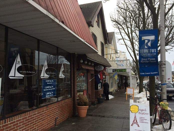
TOMS RIVER – The downtown waterfront area could look much different in the coming decades as the town has rezoned the area to allow for a walkable area with multi-story housing over small shops.
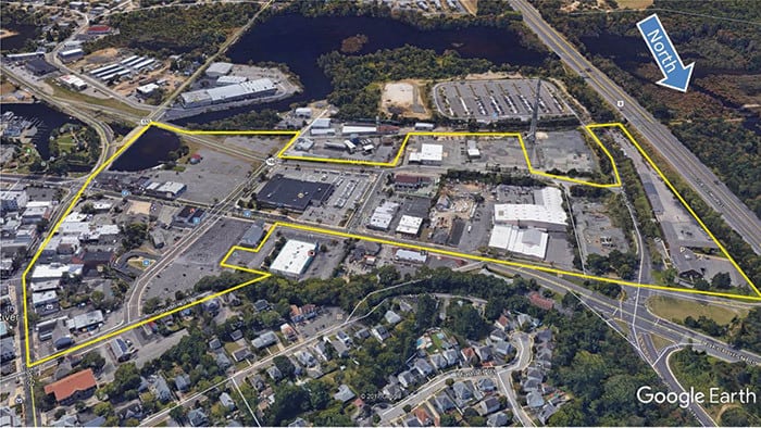
The Phase 1 of the Waterfront Redevelopment Plan allows for all the property owners to redevelop their land, even if they knock down buildings to do so, within the rules the town created. The landowners would still go through the Planning Board for approval of individual properties, township planner Dave Roberts said.
“Effectively, you’re building a neighborhood from scratch,” he said.
The area involved is between the Garden State Parkway and Route 9, and south of West Water Street. It also includes an area north of West Water Street, following Irons Street to Route 9 and back down to West Water Street (including the parking lots on Irons).
Property owners would be their own redevelopers, Roberts said. If they don’t have the means to do it themselves, they could partner with a developer.
There is no requirement that the property owners do anything, he said. The rezoning just sets parameters for property owners to make the most of what they have.
The picture painted by the plan is a series of street-level retail shops close to transportation and apartments. The idea is that the shops and the residences would support each other.
It would be designed to be an aesthetically pleasing “sense of place” that would be “capitalizing on views of the Toms River and proximity to the historic seaport waterfront,” according to the plan.
There are also designs to protect the area from flooding, since the low-lying area is subject to it, and even more susceptible to Superstorm Sandy-level flooding.
The kinds of residences were also planned. No more than 5 percent of them would be studio apartments. No more than 20 percent would be one-bedroom. There would be exactly 20 percent three-bedroom apartments. The rest would be two-bedroom apartments.
Townhouses, of no more than three bedrooms, could be three and a half stories tall. These are not allowed on Water Street or within 100 feet of it.
Recreational areas are welcome as well, such as pocket parks, playgrounds, spray parks, kayak launches, an ampitheatre and an outdoor skating rink are welcome. A minimum of 20 percent of the project would be public space like this.
There is a list of options for the kinds of street level businesses, including bakeries, medical facilities, retail kiosks, art studios, professional offices, brew-pubs and coffee shops. Hotels, motels, and bed and breakfast inns are allowed.
There is also language that requires each individual application to be considered in how it works with its neighbors. Other rules describe the trees that can be planted for decorative purposes, and the architecture preferred.
Specific Area Changes
Some specific properties were noted in the plan, with examples of what could happen to them.
The post office was one of them. The plan suggests replacing the wide, flat building with a tall, skinny one. This building would be three stories, so it would take up less space. There could be residences above it, and the entire complex would be supported by a parking deck. The Post Office would earn revenue from this plan, Roberts said, although he’s not sure if the Post Office is able to make revenue in this way. It might have to subdivide the property somehow and sell off development rights.
The bus depot would also be improved, and a “transit village” could be built there. This would be a multifamily residential development along a bike path and near a parking garage.
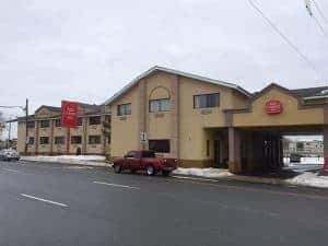
The Red Carpet Inn property would be acquired in this plan to build a berm and to raise Herflicker for flood mitigation.
The parking lots on Irons Street could continue to exist, and could be redone to be multi-level parking for nearby uses, for example, more retail with residential on top.
An extension of Huddy Park and the extension of the Barnegat Branch Trail bike path are incorporated in the plan. The park is expected to have a berm for flood mitigation and an elevated walkway. Then, there would be a beach area for paddle sports.
One potential part of the plan includes the removal of a bank building that would allow Washington Street to continue as a pedestrian-only open area mall.
Building Heights
The heights of the buildings would be staggered to “create visual diversity” within a given project. There would be a maximum of 50 percent of buildings that would be two to four stories. There would be a maximum of 20 percent that would be five to seven stories. There would be a maximum of 10 percent of eight to ten stories.
The higher buildings would be available in order to allow the property owners to make a profit on their new projects, Roberts said. It gives them incentive to make a change. In order to qualify for more dense development, they have to provide improvements in the area for the general public to enjoy, and they have to make roadway improvements to handle the traffic.
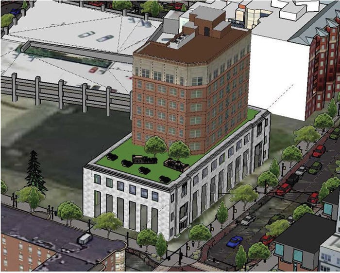
The higher buildings would be farther from the river, the central component of the aesthetics, he said. Therefore, closer buildings would be lower and the further buildings would be higher, and there would be more river views. Essentially, the township wants people close to the river, not industrial sites.
Traffic Proposals
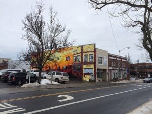
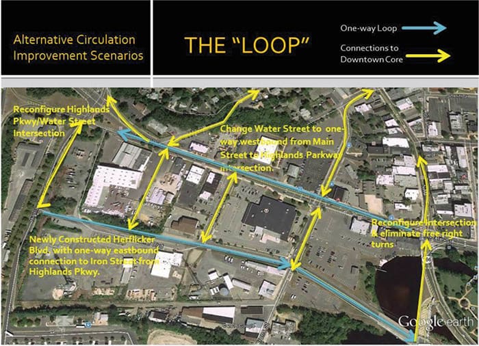
Several new traffic changes are proposed in the plan. One of them is a new ramp for northbound access to the Garden State Parkway that would come from Highlands Parkway north of Water Street. Another idea is to extend Herflicker to Highlands Parkway, and have a one-way loop so that cars would go east on Herflicker, north to the intersection with Route 9, and then west on Water Street.
Most, if not all, of the intersections would need some improvements.
Those who want to go to South Toms River and Beachwood from the Parkway could take Exit 80, and then make a right on Highland Parkway. They would make a left on the new Herflicker Boulevard, and take that over the existing bridge right into South Toms River, bypassing most of West Water Street and making that area less congested, Roberts said.
The plan is for the area to be walkable, and even have a bike path. There would be spaces in the residential developments for bike storage.
While the area would have accessible parking, there would also be a reliance on the Toms River Bus Depot. Other possibilities for transportation include accessibility by boat, and a trolley or shuttle sponsored by a developer or the Downtown Toms River group.
Timeline
There will be years before any of this comes to fruition. The projects would be lengthy and complex proposals before the Planning Board. Toms River owns some of the land. New Jersey Natural Gas is involved in a clean-up on some of the property, and that will take many steps, Roberts said.
The project was going back to 2009, but never adopted a plan until now.
Support
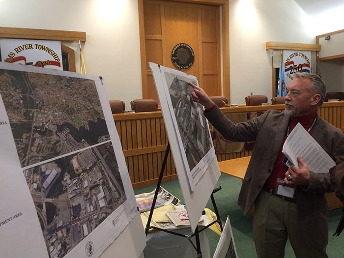
The plan met with support from locals at a recent Township Council meeting.
Joseph Kostecki, the business administrator of South Toms River, said he is looking forward to the changes. His borough is undergoing some redevelopment currently.
“We think we’re going to be redeveloping hand in hand,” he said.
Alizar Zorojew, executive director of Downtown Toms River, a business improvement district, said the planners did a fantastic job on this.
“The plan is great but it’s the execution that will really matter,” he said.
Lance Chambeau, owner of the River Lady, said he endorsed the plan as “a great step forward.”


