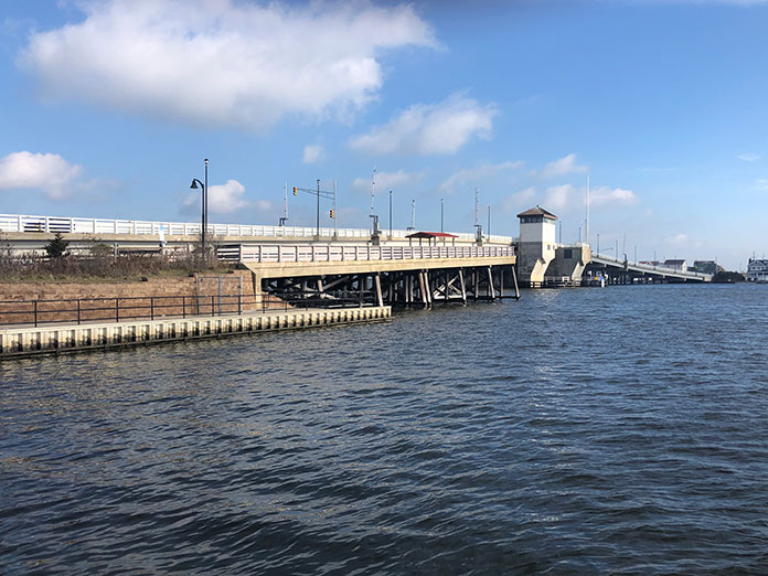
BRICK – The county-owned Mantoloking Bridge was only a few years old in 2012 when a new inlet formed and slammed its eastern end, as a result of Superstorm Sandy. Initially, it was reported that the bridge had sustained heavy damage, but engineers said that aside from some repairs needed at the base of the bridge, it was still structurally sound.
The bridge was the third Mantoloking Bridge built near the same location. Before that, the only way to get from Brick to Mantoloking was by boat, at a time when there wasn’t even a road between Mantoloking and Bay Head, which was then still part of Brick.
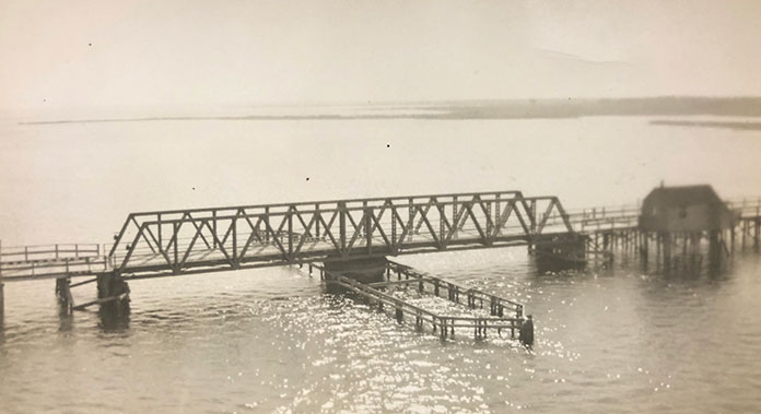
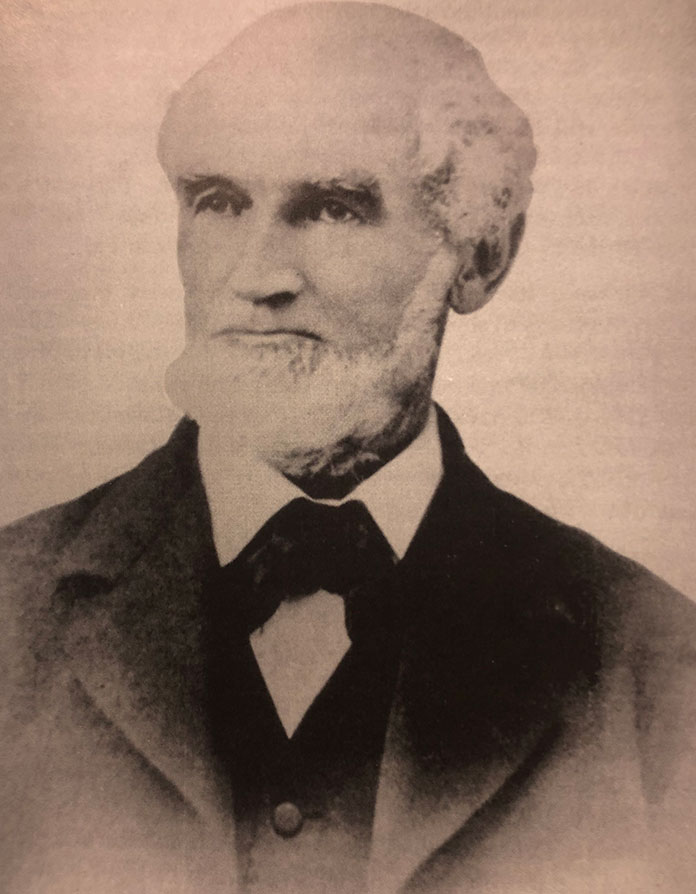
Captain John Arnold is responsible for building the first Mantoloking Bridge in 1884. He is also the person responsible for making Point Pleasant Beach a tourist town by encouraging the railroad to extend its line as far as Seaside Park. (Arnold Ave. was named after him).
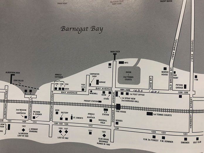
The south side of Mantoloking was developed first. With the 1881 arrival of the railroad, the 1884 construction of the first bridge, and the 1908 completion of what is now Route 35, the northern end of Mantoloking was developed.
In 1882, Captain Arnold became the superintendent of the Seashore Land Co., which was organized to sell lots for vacation homes in Mantoloking. Around this same time, the Ocean County Freeholders contracted with him to build a bridge “from Metedeconk Neck to Mantoloking.”
“It was a handsome structure, 1159 feet long, 16 feet wide with a 40-foot swing draw to allow the passage of boats,” said an article at the time. “The road from the west end of the bridge…is little more than two tracks through the sand.”
The early wooden bridge was privately financed at the cost of $4,000 and was 120 yards south of the present bridge. The first bridge tender, Thomas Sculthorpe, was paid $1 a day.
The first bridge operated for over 50 years until 1938, when it was replaced by the second bridge, which was built under the Works Progress Administration (WPA) during the depression era.
The first bridge remained in place until construction on the new bridge was finished.
Steel sections for the draw were shipped by train to the second Mantoloking Bridge. Built for $242,500, the bridge operated for 60 years until it started to show its age.
Studies showed that the bridge’s gear mechanism was damaged, and since it wasn’t built to handle modern day loads – including fire trucks and school buses – structural engineers placed a 4-ton weight limit on it. There were even reports that pieces of the bridge were falling into the water.
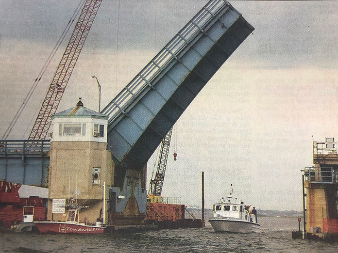
In February 2002, the Coast Guard issued a public notice outlining the proposed replacement of the 1938 bridge.
The newest bridge would have a movable double leaf trunnion bascule bridge, and the 66-year-old bridge would be demolished, except for a 160-foot section that would extend from the Brick side and serve as a fishing pier.
The bridge, constructed of concrete and steel with pilings sunk 75 feet below the water, was designed by Ted Pinca of HNTB Inc. and built by J.H. Reid of South Plainfield. There were early delays due to difficulties getting steel because of Chinese demand, but it was completed in 2005.
As compared to its predecessor, the bridge had doubled the vertical clearance over the boating channel from 14 feet to 30 feet, and increased the channel width from 30 feet to 80 feet.
Due to the added clearance, bridge openings went from 6,000 to 2,000 a year. Some 75 percent of all boats are able to pass under the bridge without the need for an opening, which results in fewer traffic delays for motorists.
The surface of the bridge has a 12-foot-wide traffic lane in each direction, plus 8-foot shoulders and a sidewalk on the south side. It replaced the bridge with 11-foot-wide lanes and 2-foot shoulders.
The project cost $23.7 million, and it was the Ocean County Board of Freeholders’ largest capital expenditure ever awarded. The entire cost was funded by the federal government.
A non-lifting bridge that would have allowed all boats to pass underneath with no interruption to cars would have required an additional 35 feet in height, and the eastern exit ramp would have extended into the sand dunes.
Information for this story was provided by The Ocean County Historical Society, 26 Hadley Avenue, Toms River. A special thanks to Janis Gibson, volunteer at the OCHS Research Center, who uncovered archival articles from The Ocean County Observer, The Asbury Park Press, articles by Mary Allsopp, and two books: “Mantoloking Through the Lens,” by Anne L. Benedict, and “An Exercise in Nostalgia Mantoloking 1880-1920,” by Frederic R. Colie.


