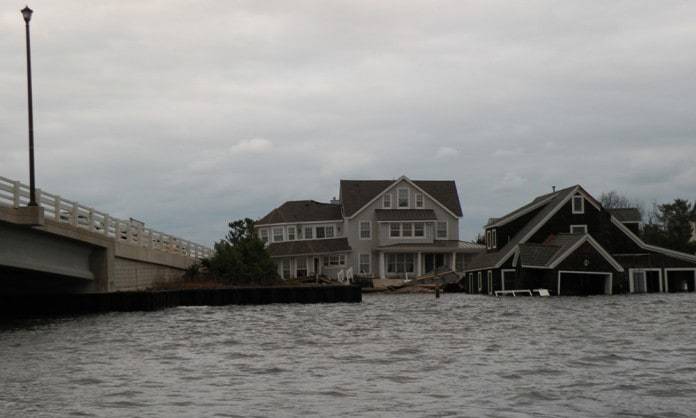
BRICK – Brick was one of the communities hardest hit by Sandy, which came ashore as an immense tropical storm in Brigantine on October 29, 2012. Heavy rains totaled about a foot in some areas, and wind gusts were recorded at 90 mph. The storm and the storm surge was amplified by a full moon, which made the high tides 20 percent higher than normal. The storm is estimated to have cost New Jersey over $36 billion in damages.
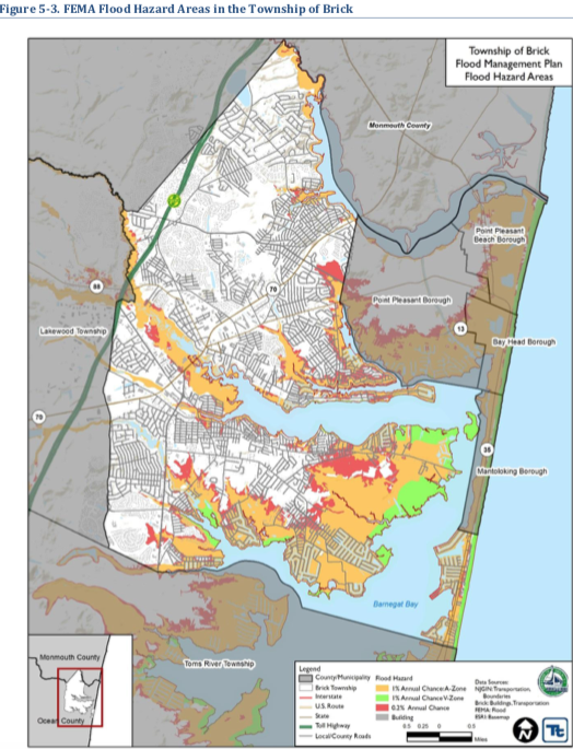
10,000 of the township’s 45,000 structures are located within the floodplain. 8,000 homes had flood damage, and over 300 were completely destroyed or needed to be demolished. The loss of tax ratables totaled over $361 million, reflecting 3.1 percent of Brick’s ratable base.
In 2016, Brick elected to participate in the Community Rating System (CRS), which is a voluntary program through the National Flood Insurance Program (NFIP) that encourages floodplain management activities that exceed the minimum requirements of the NFIP.
For communities that elect to participate, any steps taken to reduce the impacts of flooding can result in points, which can translate to discounts for residents on their flood insurance premiums.

Brick has earned over 2,000 CRS credits. This translates to about a 20 percent savings on flood insurance premiums annually for residents who live in flood compliant structures, or an average of $153 per policy and $650,270 as a community.
Each year, the township submits information to support the rating system, and goes through a reverification process every five years to continue in the program for the next five years, which was just completed in September. As part of the plan, the township’s Floodplain Management Plan had to be updated.
The mission of the Floodplain Management Plan “is to promote a safe, protected, and well-informed community with a comprehensive set of tools and the necessary capacity to identify and address vulnerabilities to flood related hazards.”
The plan identifies 140 flood hazard mitigation initiatives, and many have been completed, such as utilizing a flood warning system to assess flood threats, employing sustainable land use planning, clearing stormwater drains and culverts, preserving open space and beach replenishment, and much more.

During Sandy, an extensive breach on the barrier island occurred near the foot of the Mantoloking Bridge, which existed as “Herring Inlet” in the 18th century. The Floodplain Management Plan describes the efforts undertaken to close the inlet by the US Army Corps of Engineers, who used 54,000 tons of sand, 200 tons of stone, and 2,200 tons of rip rap to close the inlet.
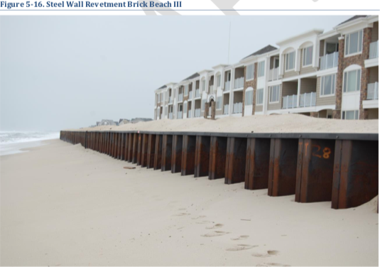
In 2015, the NJDEP and Federal Highway Administration created a stable seawall there by installing a 3.5-mile steel barrier to protect Route 35 and the oceanfront homes with 45-foot steel panels, which were driven 30 feet below sea level. Part of the project was the creation of new sand dunes and dune grass plantings.
The township has earned CRS credits by obtaining electric grid maps to assist in recovery after disruption of power. Also, utilities have improved their infrastructure and capacity to allow for uninterrupted service during hazard events. Some of the roads, especially roads that serve as evacuation routes, have been elevated, and emergency evacuation route signage has been enhanced.
CRS credits have been awarded for improved hazard-resistant building standards, which has resulted in more storm-resistant coastal development. Also, social media is being utilized to provide storm and hazard updates, and the administration has an active role in developing stormwater management projects in the watershed.

The plan even identifies funding sources to implement many of the mitigation strategies for the township to achieve the mitigation goals.
To view the Floodplain Management Plan visit bricktownship.net/wp-content/uploads/2021/10/2021-Township-of-Brick-Floodplain-Management-Plan.pdf


